Land Surveying Q & A
Since you may require the services of a Professional Land Surveyor only once during your lifetime, you may not be aware of the logical steps to be followed when selecting a Surveyor.
In general, a survey should be made before purchasing real property, when dividing a parcel of land for sale, or when adjusting existing parcel boundaries (in conformance with state laws and local ordinances) and prior to the construction of any improvements on the property in which you have an interest.
Remember, the services of a Surveyor today will cost less in time, worry, and money than the cost of moving improvements or defending a lawsuit later
What can a Surveyor do for you?
- Advise you on whether or not you actually need a survey, and what costs are associated with the type of survey you need
- Find your existing property corners and mark them so they can easily be identified
- Establish new markers and monuments for missing property corners
- Locate buildings, fences, encroachments and other improvements in relation to the property lines and prepare “As-built” survey drawings, sometimes referred to as a Mortgage Survey when used for real estate financing
- Perform boundary surveys and prepare boundary maps or “plot plan” survey drawings showing the boundary information and proposed building construction for government Building Permit applications
- Collect topographic and As-Built field data, create topographic and planimetric maps showing contours, elevations, and other existing site information
- Prepare route surveys for roads and engineering design surveys; set construction stakes from engineering or architectural design plans
- Provide positioning surveys to determine exact latitude and longitude of features or control points
- Advise and cooperate with your attorney, title insurance company, realtor, broker, engineer, or architect
- In court as an expert witness in a lawsuit.
What information does the Surveyor need from you?
- A legal description of the property (lot, block and subdivision name, aliquot party description, or deed recording information)
- The exact purpose of the survey
- A copy of title search or title insurance
- A copy of plats or plans showing boundaries
- All information regarding disputes over corners or boundaries
- All information you may have about the location of you lines or corners
- Provide the surveyor with as much information as you can about your corners, boundaries, or past surveys, even though you may believe that the information might adversely affect your holdings, it is important to understand that although you may really only want your own boundaries surveyed, the surveyor is also determining the boundary of the adjoining land, and must be impartial in the location of these boundaries. Frequently more time is spent verifying the point of beginning than is spent in laying out the property corners.
What are the Types of Surveys?
Record of Survey or Boundary survey: A survey for the express purpose of locating the corners and boundary lines of a given parcel of land. This involves record and field research, measurements, and computations to establish boundary lines in conformance with Alaska state law. Easement lines may also be located, if requested, with this type of survey.
Construction Layout Survey: Survey Measurements made prior to or while construction is in progress to control elevation, horizontal position, dimensions, and configuration, i.e. stake out of line and grade for building, fences, and roads, etc.
Mortgage Location Survey, Plot Plan or As-Built Survey: A survey performed to obtain horizontal and or vertical dimension data so that a constructed facility may be delineated, i.e. foundation survey, or as-built of improvements. Specifically, an as-built survey is a survey to physically locate structures and improvements on a parcel of land, generally for mortgage purposes. This does not always include boundary monumentation.
Topographic Survey: A survey locating topographic features—natural and man-made—such as buildings, improvements, fences, elevations, trees, streams, contours of the land, etc. This type of survey may be required by a governmental agency, or may be used by engineers and/or architects for design of improvements or developments on site.
ALTA/ACSM Survey or Extended Title Insurance Coverage Survey: A survey made for the purpose of supplying a title company and lender with survey and location data necessary for issuing American Land Title Association and Extended Coverage Title Insurance.
Subdivision replat: Includes moving a boundary between parcels of land, or creating one large parcel from two or more smaller parcels.
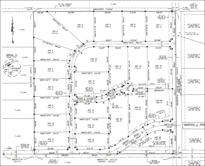
Subdivision Survey: The subdivision of a tract of land into smaller parcels, showing monumentation and survey data on a map, in conformance with local ordinance and Alaska state law.
How can you obtain the services of a Land Surveyor?
Only a Professional Land Surveyor licensed by the State Board of Registration is legally permitted to perform land surveys in the state of Alaska.
Most active surveyors are listed in the yellow pages of the telephone book, or a listing may be obtained from the Alaska State Board of Registration for Professional Architects, Engineers and Land Surveyors.
Choose a reputable surveyor in whose skills and judgement you can put your trust. A surveyor should not be selected by price alone, competency is of first importance. Your selection should be made when you are sure that the professional you have chosen has all the facts, and is completely aware of your requirements and/or the requirements of the governmental agency having jurisdiction over the property.
Ask someone who has employed a competent Surveyor.
Surveyors like other professionals, vary in knowledge and ability. The experiences expressed by clients have shown that the majority of Land Surveyors provide competent work for a reasonable fee.
Do not let anyone but a Professional Land Surveyor decide your survey requirements or prepare the legal property.
How much will a survey cost?
Surveyors fees, like those of other professionals, are dependent on the types of services required, which in turn determines the level of effort, the number of personnel and type of equipment necessary. The following factors help determine the final cost of a survey.
- Information available
- Research required
- Clarity (or vagueness) of the legal description
- Amount of land involved
- Number of property corners
- Improvements such as houses, outbuildings, fences, etc.
- Terrain & Vegetation
- Accessibility
- Boundary disputes
- Personnel and equipment required
- Surveyors familiarity of the area
These variables make it difficult to determine exact fees, but based on general experience in the area and the type of work required, the Surveyor can furnish an estimate of costs. Surveyors familiar with an area or locale are typically more efficient than those who are not.
What are the Methods of Surveying?
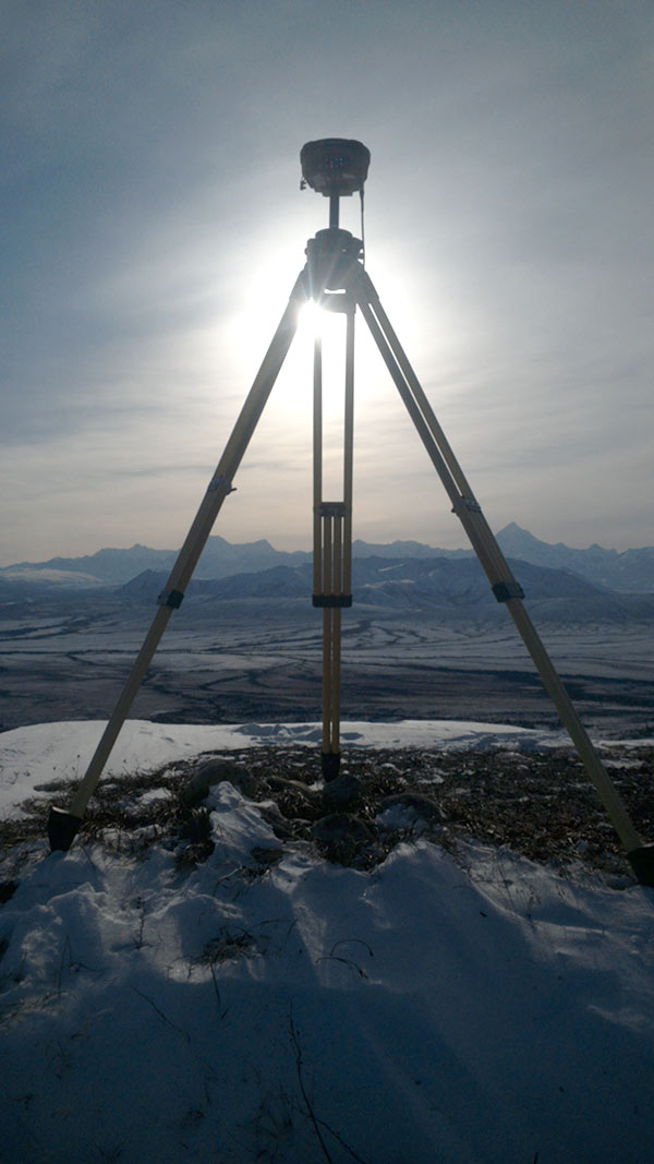
Most Surveyors use electronic distance and angle measuring equipment, as well as the traditional transit and tape. Some Surveyors may use satellite positioning equipment as a measuring tool. Modern computer systems aid in efficiency gathering measurements and in evaluating all collected evidence required to perform the survey. The Surveyor takes pride in being able to use these instruments and computers to perform land surveys efficiently, accurately and cost effectively.
What is the Law Regarding Right of Entry?
Surveyors do have a right to enter on your land for survey purposes. According to Alaska Statutes Section 34.65.020. “A land surveyor or employee of a land surveyor may enter public or private land or water in the state only to occupy, locate, relocate, install, or replace survey monuments, to locate boundaries, to determine geodetic positions, and to make surveys and maps.” A surveyor shall give reasonable notice to the owner or occupant of the land.
 From Subdivision Design and Land-Use consulting to Road Inspections, Mortgage Location Surveys and individual property surveys, 3-Tier Alaska is the leader in the interior of Alaska for Subdivision Design & Platting. We are experts in navigating the Fairbanks North Star Borough Title 17 and Department of Natural Resources platting requirements.